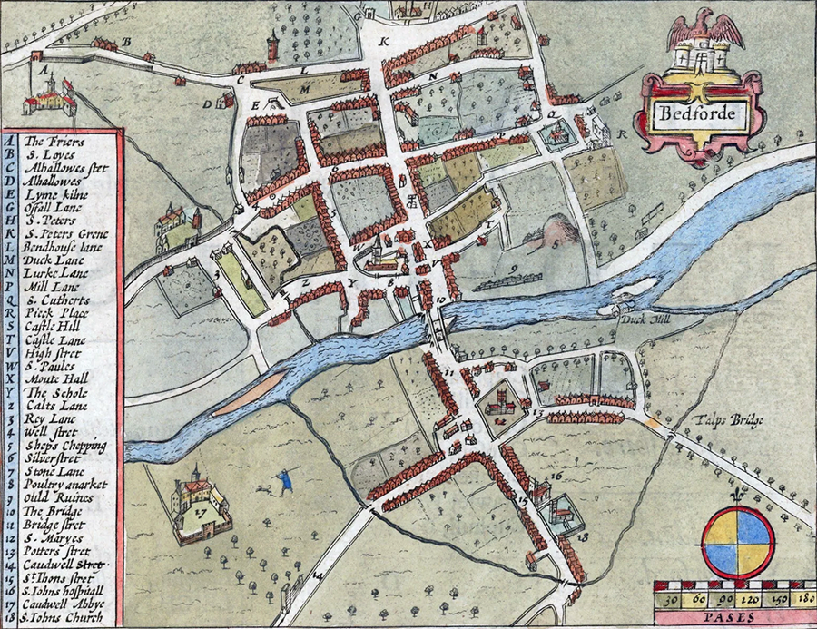
Bedford’s town bank and the accompanying King’s Ditch were defences built on the south side of Bedford, probably in 915, and which remained in use until after the Norman conquest of 1066. Only fragments of the ditch and earthworks still survive.
History
In the Anglo-Saxon period, the town of Bedford lay on the borders of the kingdom of Wessex and the Danish-controlled Danelaw. The region saw extensive conflict. By 900 AD Bedford was a burh, or defended town, probably with defences running around it on the northern side of the River Great Ouse.
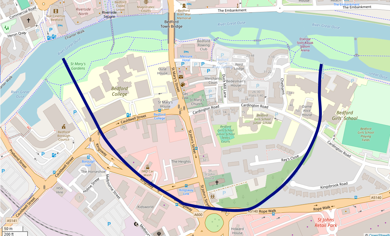
Around either 915 or 919 AD, Edward the Elder occupied Bedford and gave orders for the southern side of the town, across the river, to be fortified. This appears to have resulted in the King’s Ditch being dug and a defensive bank being constructed within it. The waterfilled ditch ran in a loop southwards from the river, enclosing a defensible area. A stone weir provided the force to enable water to flow continuously along the ditch back into the river downstream, minimising the need for maintenance. Later in the medieval period, fishponds were constructed inside the ditch along its south-east side, fed by water from the ditch. The defensive bank was perhaps 5 m high from the level of the ditch.
Despite the new defences, Bedford was captured and burned by the Danes in 1010. King’s Ditch and the defensive bank remained in place, however, until after the Norman Conquest of 1066 after which they eventually seem to have fallen out of use as town defences. The ditch and bank were maintained and heightened for several centuries afterwards, however, possibly for their value in flood control or for transportation.
In the 21st century, only portions of the ditch and bank survive, although narrower and more silted up than in pictures from the early 20th century. The medieval weir is visible under the river in aerial photographs – again, it was much more prominent in the late 19th and early 20th century.
Bibliography
- Edgeworth, Matt. (2011) “The weir and the flowing earthworks of Bedford”, British Archaeology No. 121.
- Haslam, J. (1983) “The origins and plan of Bedford,” Bedfordshire Archaeology Vol. 16 pp. 28-36.
Baker, D. (1979) “Excavations in Bedford, 1967-1977,” Bedfordshire Archaeological Journal Vol. 13. - Hassall, J. and D. Baker. (1975) “Bedford: Aspects of town origins and development,” Bedfordshire Archaeological Journal Vol. 9 pp. 75-94.
- Hill, D.H. (1970)”‘Late Saxon Bedford,” Bedfordshire Archaeological Journal Vol. 5 pp. 96-69.
Attribution
The modern map in this article is based on OpenStreetMap open data, licensed under the Open Data Commons Open Database License (ODbL) by the OpenStreetMap Foundation (OSMF).