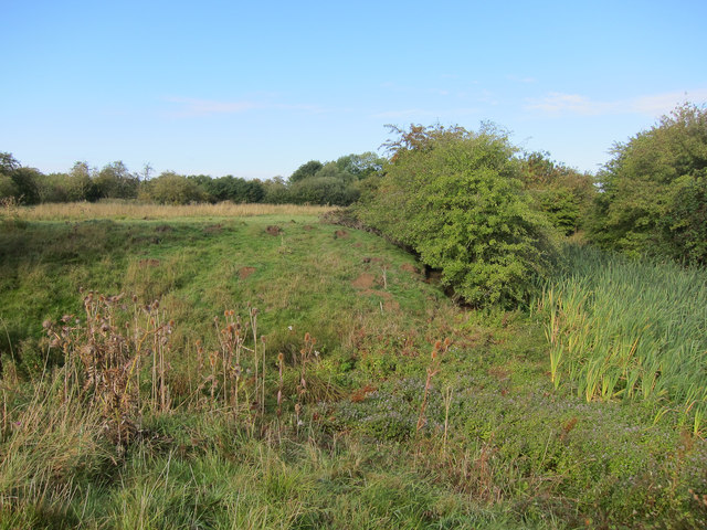
Caxton Moats is a moated, medieval fortification to the west of the village of Caxton in Cambridgeshire. Probably originating from the civil war of the 1140s, it was later used as a manor house before being abandoned. Only earthworks now remain.
History
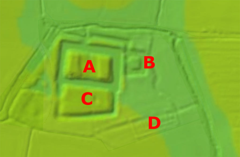
Caxton Moats is a medieval fortification to the west of the village of Caxton in Cambridgeshire. It consists of three moated enclosures and some associated fishponds.
The main enclosure is in the north-west of the site, and is approximately 75 m by 45 m (146 ft by 148 ft) across, with a water-filled ditch up to 18 m (59 ft) across and 2.5 m (8 ft) deep. The west and east ends of the enclosure support earthwork platforms, now 1.5 m (5 ft) high. The second enclosure lies to the south, and is of a similar size and shape, with a narrower, dry ditch, 12 m (39 ft) across and 2 m (6.5 ft) deep. The third enclosure is smaller, approximately 17 m (55 ft) square, and occupies the north-east corner of the site. The enclosures would originally have been accessed and linked by bridges, since lost.
It is uncertain when they were constructed. After the Norman conquest of 1066, Caxton was given to Hardwin de Scalers, and it remained in the Scaler family for over a century. A castle at may have been built at Caxton Moats in the 12th century, possibly during the civil war known as the Anarchy, forming part of a range of similar defences at Lidgate, Lindsey, Milden and Offton. If so, the fortification may have resembled the similar rectangular motte at Burwell, built around 1143. At this time the heart of the village of Caxton lay just to the south of the site, clustered around the church of St Andrews.
The Caxton manor passed by marriage to the de Freville family in 1231, and there are historical records that by 1312 the site held the dower house of Lady Eleanor de Freville, who had retained a third of Caxton after the death of her husband, John de Freville. Probably the fishponds and other water features on the south-west of the site were built around this time – these would have been prestigious features of the house – and any parts of the enclosures not constructed in the 12th century probably date from this period. At some point, small earthworks, called “pillow mounds”, for farming rabbits were established on the property. The de Freville’s redeveloped the village, creating a market along Ermine Street further to the east of Caxton Moats, to where the centre of the village eventually moved.
Caxton Moats appears to have fallen out of use, although the exact date is uncertain. The Cages and later the Boveys acquired the surrounding manor in the 16th century, and by 1750 the site, then known as “Moat Close”, had no buildings on it. In the 21st century, Caxton Moats is protected under UK law as a Scheduled Monument.
Bibliography
- Creighton, Oliver H. and Duncan W. Wright. (2016) The Anarchy: War and Status in 12th-Century Landscapes of Conflict. Liverpool University Press: Liverpool, UK.
- Elrington, C.R. (ed) (1973), Victoria County History: Cambridgeshire and the Isle of Ely: Volume 5. University of London Historical Research Institute: London, UK.
- Cambridge County Council. (2015). Cambridgeshire Extensive Urban Survey: Caxton. Cambridge County Council: Cambridge, UK.
- Royal Commission on the Historical Monuments of England. (1968) An Inventory of Historical Monuments in the County of Cambridgeshire. Volume 1: West Cambridgeshire. HMSO: London, UK.
Attribution
The text of this page is licensed under under CC BY-NC 2.0.
Photographs on this page are drawn from the Geograph and the UK’s Department for Food and Rural Affairs websites, as of 5 December 2021, and attributed and licensed as follows: “Caxton Moats“, author Hugh Venables, released under CC BY-SA; “Lidar map“, copyright the Environment Agency, released under Open Government License 3.0.