Ascott Earl Castle is one of several castles in the Oxfordshire village of Ascott D’Oylly. The castle was probably built soon after the Norman Conquest, probably by Ilbert de Lacy. It had a motte-and-bailey design, with timber and earthwork defences. It soon fell out of use. After 1130, another fortification, Ascott D’Oylly Castle, was built along the river, close to the site of a probable earlier, temporary castle, Ascott D’Oylly II.
History
Ascott Earl Castle was probably built soon after the Norman conquest of England in 1066. In the 11th century, the settlement of Ascott Earl lay to the west of Ascott d’Oylly, both of which formed part of Shipton-under-Wychwood, a major royal estate, and a probable late Anglo-Saxon settlement. After the conquest, Ascott Earl was granted to Bishop Odo of Bayeaux, who appointed Ilbert de Lacy as his tenant.
The castle was probably built on an older Anglo-Saxon site. It does not appear to have been used for long, and may have fallen out of use early in the 12th century. Another castle was built in Ascott d’Oylly around 1130, around one kilometre (0.6 miles) along the river, which survived until around it was demolished 1174.
The castle site was rediscovered by Martyn Jope following archaeological investigations in 1946. In 1971, threats to level the earthworks resulted in the site being protected under UK law as a Scheduled Monument.
Architecture

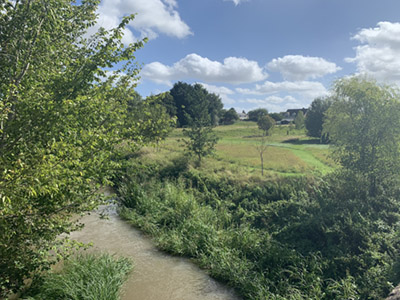
Ascott Earl Castle is located above the River Evenlode on a natural spur, overlooking the river’s flood plain. It had a motte and bailey design, with timber fortifications, and protected by the river along one side. Parts of the earthworks have since been destroyed.
The motte is now 56 m (184 ft) in diameter across at the base and up to 45 m (148 ft) across the top , and stands 3.5 m (11 ft) high. Ramparts and a bank ran around the outside of the motte, fragments of which survive on the north side. The bailey was crescent-shaped, approximately 70 m by 30 m (230 by 98 ft) across, also protected by ramparts and a bank. The motte and bailey were separated from the motte by a ditch up to 10 m (33 ft) wide, crossed by an earth causeway on the south-west side. The castle would probably have been entered through the motte, across a low ridge leading from the nearby road.
Bibliography
- Aston, Mick. (1972) “Ascott Earl,” South Midlands Archaeology: CBA Group 9 Newsletter, Volume 2 p. 30.
- Bond James. (2001) “Earthen Castles, Outer Enclosures and the Earthworks at Ascott d’Oilly Castle, Oxfordshire,” Oxoniensia, Volume 46 pp. 62-63.
- Jope, E. Martyn and Threlfall, R. (1959) “The Twelfth-century Castle at Ascot Doilly, Oxfordshire: Its History and Excavation,” Antiquaries Journal Volume 39 p. 239.
Attribution
The text of this page is licensed under under CC BY-NC 2.0.